The YUKON!
When people asked us about the extent of our northern tour, I skeptically told them Cody wanted to make it all the way to Whitehorse. This response likely came across dripping in skepticism and people were surprised by our ambitious goal of making it all the way to the Yukon with the truck and trailer. I’ll admit, I overlooked the territory – there couldn’t be much to do in the frozen tundra – and our ability to drive THAT far. Was I ever proven wrong!

Marsh Lake
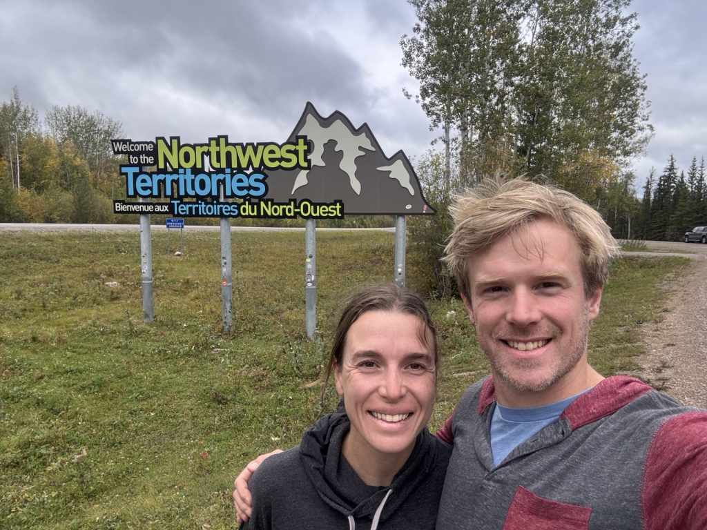
We left the beautiful blue waters of Boya Lake and set off towards Whitehorse. With long stretches of road between gas stations and rest stops, Cody mapped out the distance between pit stops. We passed through areas once ravaged by wildfires, but it looked as though the vegetation was recovering beneath the blackened trees. These fires happened at least 10 years ago, with some dating back to the 1950s. In these more remote areas, unless the fires threaten the road or the few population centres, they’re left to burn themselves out. After two hours of driving through sparsely treed marshy areas and too many lakes to count, we made it to the Yukon border! Just after, the Stewart-Cassiar Highway meets the Alaska Highway at Junction 37, then briefly dips back into BC before curving north again towards Whitehorse.
We stopped in Teslin to do a much-needed load of laundry and fill up on water. In these remote towns, we’ve noticed that gas stations often offer many essential goods and services like groceries, coffee, camping, motels, outdoor gear and laundry for passer-byers and locals alike. The Alaska Highway’s most prominent users, we surmised, were RVers and travellers. Most people were heading south at this time but there were still a few, like us, ready to embrace the cooler nights. Thankfully, the days are still warm and we have 14 hours of daylight, even if the sun is at a low angle.
We arrived at Marsh Lake Territorial Campground and set up by the lake, of course. It was windy and cool, with white caps building on the large lake, so we hunkered down in the trailer for the evening. The next morning, we woke up to frequent banging, which we just assumed was a tinkering neighbour. It turned out, the squirrels were in full foraging mode. The sound we heard was them firing spruce cones down from the treetops onto the outhouse steel roof! Their impressive stockpiles were scattered throughout the park, which prompted a bunch of questions – is winter stockpiling a solo or group effort? Is thievery common? Are there squirrel truces? We still don’t know …
We then headed to the Mt McIntyre trail network just west of Whitehorse. I won’t say that mountain biking was the reason we headed this far north, but it definitely was a reason. In fact, in 2013, the magazine Outside named Whitehorse and nearby Carcross the biking destination of the year.
We did most of the 2023 Canadian Cross Country Marathon Championships loop, which was about 26k. The trails were not super technical nor hilly, which meant lots of pedaling and fast flat sections. I think it would be a fun racecourse, albeit tough, because there weren’t many spots to just sit and coast. As we finished the loop, the rain really started pounding, so we did a couple short jump line laps in the bike park and then raced to the truck. We stopped in Whitehorse for groceries, slippers and fuel. Let me tell you – those slippers were such a game changer. On the cold nights and mornings, the trailer floor felt (to me) just slightly above the temperature outside. So, having a cozy layer in between the floor and my feet was luxurious!
That evening, a group of young Irish folks next door asked if they could borrow our hatchet to split some firewood. They must have witnessed my laughable attempt at splitting kindling and thought it would be fun to try it themselves. The poor lads hacked away at the logs for about an hour to get enough pieces for the night. It was slightly entertaining, especially hearing their Irish slang, but we had to applaud their efforts!
We received some sunshine the next day, but it was fleeting. The colder temperatures were the push Cody needed to insulate the front of the trailer with the foam board we had been carrying around since Port McNeil (over a month ago!).

King’s Throne
We had initially considered trip camping for a night in Kluane National Park Reserve, but upon seeing the forecasted overnight temperatures hovering around zero (these temperatures would have pushed the limits of our camping gear and my cold threshold), we opted to make a day trip instead. The drive to the park was two and half hours of mostly flat open roads. Once we got into Kluane Country, older moraines transitioned to frosted jagged peaks. And the mountain range just kept expanding as we got closer.

When we arrived at the Kathleen Lake parking lot around 11 A.M., it was still quite cool, with frost on the shaded grasses. We set off on the 13k trail wearing all our winter gear and with lots of snacks and water. As soon as the grade kicked up and we got into the sun, it was instant summer and we frivolously shed multiple layers. Cody mentioned it was going to be a steep hike, but I don’t ever really know what we’re getting into until we’re on route – for better or worse. The first push was through a scree field. It was steep enough, but the footing was decent. We met some couples at the cirque, which sat at the end of the “trail” and offered a natural place for a break. The rest of the way to the summit is referred to as a “route,” which is less obviously marked and maintained.
We pressed on and the grades really kicked up – like 40 per cent up. It was basically a staircase without any steps, just boulders to navigate. The marmots made their presence known by chirping at us and scurrying away through the rocks. It was still cool enough at this elevation that the shaded rocks were outlined in frost. Then, we were on the snowline. And then, on an exposed ridgeline spine. A skinny, steep-on-both-sides, scrambly spine. After a few deep breaths and some encouragement from Cody, I kept climbing.
I can’t really explain what happened, but the motivation/fear of getting to the top resulted in tunnel vision and I basically power hiked until I got to the plateau – leaving Cody behind to fend for himself. We reunited a couple of kilometres later and continued along the top ridge to the summit. Once I was able to look around, the scenery was incredible! Kathleen Lake on one side and a vast snowy mountain range on the other. The windchill on the ridge prompted our quick re-layering of winter gear. We ate our sandwiches at the summit with a breathtaking panoramic view without a cloud in the sky. After taking lots of photos, we decided we’d better head down. We could hear the echo of occasional rock falls as the sun warmed the frozen slopes.
The route down wasn’t much quicker but it was slightly easier with the help of gravity. However, loose rock gave out a few times and swept our feet from underneath us – cartoon style. Cody and I each took a butt slide, resulting in a couple laughs and bruises.
Roundtrip, we climbed over 1,300m in 13km to reach 2,000m at the summit. The kicker is that we climbed about 1,000m in just 5km! That was the real grind up and the quad shredder on the way down. When we got back to the truck, we tested the lake water for a swim. We passed on the glacial lake dip and instead found a few dock chairs in the sun to sink into. The quiet, warm and peaceful shore looked out at mountains behind mountains behind mountains. We could have easily napped for a couple hours, but we soldiered on to make the lengthy drive back to the campground.
As we hammered east on the highway, a huge elk started to make his way across the road. We and him stopped and locked eyes. He looked to be bigger than the truck and in full rut. Mr. Elk then made the last-minute decision to had back towards the roadside and struck by his beauty, we failed to get a decent picture of the majestic bull. We made it back to the campground, had sausage rolls and nearly fell asleep by the fire.
Grey Mountain
Cody found a route that took us towards the summit of Grey Mountain, another mountain bike destination to the east of Whitehorse. He had planned for just over 30k, but we both woke up with quads that were tender to the touch and extremely tight glutes and hips from the beating they took on our hike to King’s Throne.
Despite our compromised state, we embarked on this ambitious journey. The first few pedal strokes uphill were quite revealing – neither of us had much torque for techy climbs. Fortunately, the trails were quite smooth, but very steep sections awaited ahead. Cody was able to get up them just fine (with some grunting), but I spent a lot of time pushing my bike up hills.
We rode along an exposed ridgeline for awhile, which was sketchy for an intermediate rider, but offered a stunning view of Whitehorse if you could take your eyes off the trail. We climbed up for another 8km, against my better judgement, and eventually reached the summit. But of course, the summit was not enough. We continued for another 3km to see where the trailed ended. This trail “The Dream” got its namesake from the collective dream that this trail will eventually make it all the way across the mountain’s ridgeline, but at time of writing, the trail was far from done.
Without any trees at the top of Grey Mountain, we had a full 360-degree view of our surroundings. As an out-and-back route, we eventually turned around and rode down the exact trail we’d just pedalled up. It was much more fun in the other direction! There were some great rock rolls and jumps in reward for the tough climb, if you felt the scenery wasn’t enough. We diverted off The Dream onto Mother T, which was old-school cross-country mountain biking, Cody says, with lots of tight switchbacks, roots and pedalling. This trail was still lots of fun with enough downgrade to keep the pedalling fast!
Atlin
We made a day trip back into BC to check out the town of Atlin. Atlin Lake is Canada’s largest natural lake running 137km north to south! Due to the length of the lake and the area’s topography, the town of around 500 people has one main road, Atlin Road, that connects it to the Yukon. On our way into town, we stopped at Como Lake Recreation Site for a mountain bike ride. It was a short 7km loop, but thought, why not! We pedalled up a beautiful and smooth climb trail that eventually led to the most picturesque lake to mountain backdrop you could imagine. In fact, Cody mentioned that if someone was asked to paint a beautiful BC landscape, this view would probably be it. From the trail we looked out onto Atlin Lake and its surrounding mountains. After over feasting our eyes on the scenery, we carried on to the top of the trail.
Once we began our journey down, we were pleasantly surprised! The trail had fast berms and fun jumps all the way to the bottom. What a perfect hidden gem! We considered doing another lap but hopped back in the truck and headed into town for lunch.
Atlin has maintained a lot of its historical buildings for tourists to see. The town was founded in the late 1890s as an offshoot of the Klondike Gold Rush. It’s small, but has a bakery, gas station, coffee shops and the delicious diner we visited – The Mountain Shack. We got two ginormous western sandwiches with sides, and that’s saying a lot coming from two hungry people! We walked around the town a bit longer and then headed towards Carcross. We passed through the small river town of Tagish and then arrived at the Carcross Desert. It’s a vast area of sand dunes that was once an ancient lake. We were just driving along and suddenly bam! A desert on the side of the road. We walked into the sandy landscape but saw lots of people with ATVs and trucks exploring the dunes.
We then headed into the historic town of Carcross and had some ice cream. We read about Skookum Jim Mason who was of the Carcross and Tagish First Nations. He was one of the Klondike Gold Rush founders and contributed financial and leadership support to his community. He would spend the summers “up north” in the gold fields and return to Carcross in the winter with his family. Mason is credited with hosting the last potlach before the Canadian government banned this important Indigenous celebration from 1885 to 1951.
Whitehorse
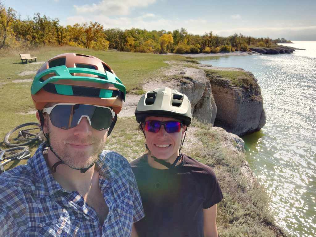
After a hearty breakfast of scrambled eggs and hashbrowns, we headed into Whitehorse to start another big bike loop. This route was around 45km, but with fewer punishing climbs along the Yukon River. It was a sandy narrow trail that paralleled the river at the top of a steep bank. Thankfully it was smooth because one wrong move and you’d be hurdling down the riverbank into a fast-flowing Yukon River! Despite the fear factor, it was an epic 12k stretch along the river. In the idealist of scenarios, we would have a drone following us capturing the trail and the river, but alas, this handful of photos will have to do.
Over the 45k, we climbed just over 1,000m. Overall, it was an awesome ride seeing more of Yukon’s natural beauty. Whitehorse truly is The Wilderness City. Also, we discovered that six nights is the threshold for our freshwater tank capacity while off grid. So, for the seventh night, we relinquished all our trailer conveniences, found some drinking water to get us through a couple meals and rinsed off in the lake at the lovely beach. When push come to shove, it turns out I will voluntarily run into frigid lake!
Watson Lake
After a week near Whitehorse, we packed up on another frosty morning, turned east to make our way back to Junction 37. This stretch on the Alaska Highway felt like a big turning point in our travels: we were no longer heading farther from Ontario but finally heading towards it. On the way, we stopped in Teslin for a muffin and carrot cake – the other important driving fuel. We also stopped at the Continental Divide. This ridgeline separates two of the largest river drainages in Canada – The MacKenzie and Yukon Rivers. The Alaska Highway crosses the divide at one of the lowest points, with the Swift River flowing west into the Yukon River and eventually in the Bearing Sea (Pacific Ocean), and the Rancheria River flowing east into the Liard and MacKenzie Rivers to the Beaufort Sea (Arctic Ocean).
An hour beyond the junction, we arrived in Watson Lake where we stopped for fuel and fresh water. We found a great first come, first serve campground at the nearby Territorial Park and Cody recovered from a five-hour driving day. We cooked some juicy burgers and poured a cup or two of champagne to toast to our trip’s last night in the Yukon.

A unique thing that we noticed about the Yukon is the sheer vastness of the territory. We would go long stretches on the highway without seeing cars, buildings, hydro lines or people. We also noticed that Whitehorse invests in active transportation. Trail networks are accessible just outside of the city limits and many bike and walking paths run alongside major roads. During our short time here, it was evident that Whitehorse sees the value in promoting active living.
Now, a quick jaunt east before heading north again – we’re not done with the territories yet!
How did we get here? Check out previous posts below:



3 Responses
Awesome story telling Kate and great pictures.
I am a little bit jealous haha !!
Thanks for making the effort to send us a journal of your trip 🙂
Keeping up the blog has been fun for us, too! Helps me remember where we’ve been! haha