We wrapped up August just south of the territorial border and continue to head north
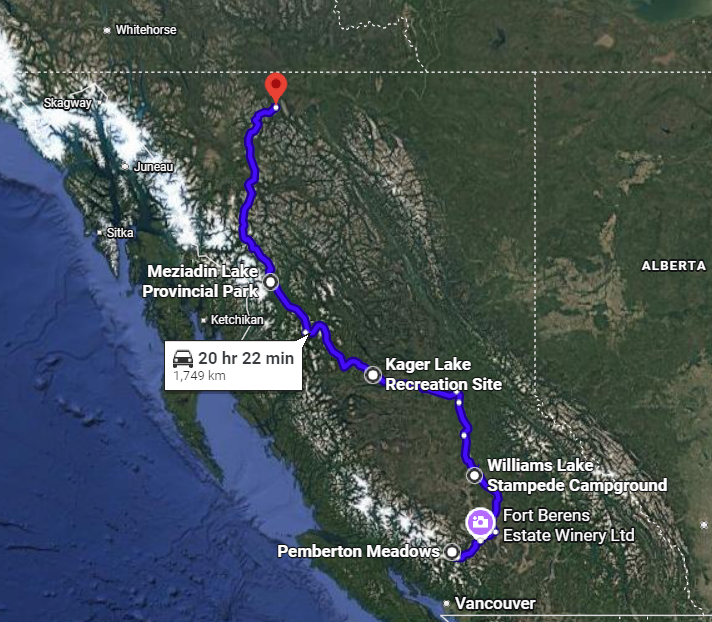
Coming from the Island, I viewed Williams Lake as “pretty far north.” I maybe even considered it part of Northern BC. However, as we drove, I was reminded that BC is quite expansive latitudinally – the most direct route from Victoria to the northern provincial border is over 23 hours of driving. After nearly six weeks of travelling, we still were not even halfway through the province! But after a few big days on the road, we made it to the more remote and wild areas of Northern BC proper.
Williams Lake
While we second-guessed our plans to leave Pemberton Meadows, after three big days on the bike, we packed up and hit the road. I tried to mentally prepare for the drive along Duffy Lake Road because both my dad and Cody mentioned how hairy it can be. Oh goody, I thought!! We carefully made our way through the hairpin turns and tough grades up the mountain pass. The road climbs to over 1,300 meters at the Cayoosh Summit and then once at the plateau, we could enjoy the views that Joffre Lakes Park has to offer – pristine blue waters and jagged peaks.
As we got closer to Lillooet, the wildfire smoke thickened and we could barely see anything beyond the side of the highway. Cody said mountains and canyons were on either side of the truck, and I had to take his word for it. Again, as someone afraid of heights, perhaps it wasn’t a bad thing that I couldn’t see the valleys that plunged below. Despite the very poor visibility, there was no mistaking that we had most certainly left the coast for arid desert. The only green blades of grass were underneath irrigation reels. Otherwise, parched tufts of vegetation covered brown and yellow hills for miles. As we approached Highway 97, we saw wildland firefighter camps and were relieved to see the highway was open.
Sidenote: When we were examining the route a month earlier, Highway 97 was closed due to the Big Bar Complex fire that devastated Clinton and surrounding areas.
As we turned north onto the highway, we could see dark plumes of smoke ahead. With some apprehension, we pushed on. As we approached the residential areas outside of the Village of Clinton, the truck fell pretty quiet. We passed by charred homes, cars, businesses, fence posts and hydro poles that lined the road. Thankfully, the town centre was saved and business signs welcomed residents home. Other towns in the Cariboo Regional District were also evacuated, and locals were beginning to return home. At 100 Mile House, we saw a helicopter and its giant water bucket land in a field, seemingly done for the day.
After five hours of driving, we made it to the Williams Lake Stampede Campground. While we had no idea what to expect, we could not have guessed we’d drive up to a giant amusement park on the grounds. Carnival rides roared, people screamed and we cooked in the 35oC smoky air. Up to this point in our trip, we had taken clean air and moderate temperatures for granted. Within the wide swath of BC that was blanketed in smoke at the time, we couldn’t see much beyond the campground as the treelines were grayed out almost entirely. Amidst the yellow haze, we joined in the carnival fun. Cody was keen to get into the Starship 3000 or the Zipper, which both spun around way too much, so I was not supportive!
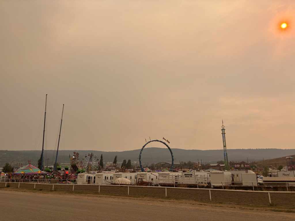
The next day brought more oppressive heat and for some unknown reason, we waited until early afternoon to ride. It had to have been near 40oC, and thick smoke hung in the air. I instantly overheated and bailed after 15 minutes. I could barely pedal up the hills and Cody had 30k on the docket. I headed back to the trailer, but he soldiered on and experienced the Cariboo’s dirt flow trails. In the meantime, I went to the grocery store and the cashier asked about the weather outside. With thunderstorms in the forecast, she mentioned how local residents get stressed when there’s a chance of lightning. With the combination of the inferno of a day coupled with lots of news stories about BC’s wildfires, I can totally understand why.
Later in the afternoon, I headed out for a wee run to Scout Island, a small conservation area not far from our site. That evening, the lightning started and we nervously watched the sky – it flashed and thunder rolled but no rain fell. All we could do was hope that a spark didn’t ignite the tinder dry trees and grass. Fortunately, it started raining overnight and into the morning. The rain seemed to clear the air and drop the temperature by over 10oC – phew!
With slightly damper ground and much cooler air, Cody took me back to the trails he rode the day prior. We rode Loose Moose, an ultimate fun and flow trail – it was a hoot! Cody had also ridden Hillbilly Deluxe and Aflow Daddy, which were steeper expert trails. All the trails were very smooth on Fox Mountain though, so the technicality came from the slope and the features built into the trails. That evening, with the smoke slightly cleared, we could finally see the glow of the sunset.
Burns Lake
The next morning, we set off due north before heading westward again. On Highway 97, also known as the Yellowhead Highway, we drove through towns including Quesnel, Prince George and Vanderhoof. It was a beautiful drive through the treed hills of the Cariboo, Fraser Fort-George and Bulkley-Nechako regional districts. Lots of cows, hayfields, and surprisingly, corn! I thought we were in “Northern BC” when we passed through Prince George, but it turns out Vanderhoof is the geographic centre of the province. This fact really highlighted how much further we needed to go before hitting the Yukon border. We continued driving to Kager Lake Recreational Site, which has only first come first serve sites. We just had to hope that there would be spots left by the time we arrived. Fortunately, many quality spots were still available. Once settled, we went for a run around Kager Lake and then made some dinner. The moon was super bright that night, so we headed out to the end of the dock to get photos and watch the fish jump.
With over 100 kilometres of trails to choose from in the Burns Lake area, the route options truly were endless. Some research showed that the trails Hogzilla and When Pigs Fly were highlights of the network. The trails are centred around Boer Mountain, which inspired the all-things-pig theme. We climbed up Huff n’ Puff, which is in relation to The Three Little Pigs bedtime story, and it was a mountain biker’s dream. The trail was dirt and smooth with wonderful grades that didn’t have us huffing or puffing too much. The trail was dotted with Indigenous paintings that each had a corresponding QR code linked to the image’s oral story.
Hogzilla was a fun and fast downhill trail filled from top to bottom with tabletops, jumps and sky-high berms. It was 4.5k of flow! When Pigs Fly was very similar but just a bit shorter in distance and tamer in the size of the features. The trail network layout was so well thought out and provides fun for the whole family, with green, blue and black trail options as well as a sizeable skills park. Later that day, yearning for more trail time, I headed out for a run around Kager and Long lakes. Again, absolutely stunning trails that one could explore for hours. The warm afternoon called for a refreshing dip in Kager Lake – perfection! In the evening, after lots of food, we were treated to a thunderstorm and lightning show.
Our takeaway from this short stay is that the area is truly an athlete’s dream as it offers trail options for everyone. The wildest part is that it’s free to camp here. FREE! Though, it is recommended that campers donate to Ride Burns, the local group of dedicated volunteers and trail builders.
We also appreciated the free potable water and sani-dump station in Burns Lake, which even had a propane refill service. Most places charge for dumping and good fresh water can be tricky to find on the road. The main motivation for the station is to provide potable water to rural residents during times of drought, but it is a convenient stop for travellers and makes Burns Lake memorable.
Meziadin Lake
After a gentle pitter patter of rain overnight, we decided to make the most of our time in Burns Lake and did one more lap of our favourite trails before heading out. While we were out there, we also decided to go for the “QOM” (Queen of the Mountain – it’s a Strava thing) attempt on the climb trail to the top. It was a valiant tempo effort after rolling out of bed, scarfing down some cereal, slurping a mouthful of coffee and hopping on the bikes. At the time of writing, I went second fastest covering 10k with 340m of elevation in just under 41 minutes. I love my bike Flo, but she is not light and is currently kitted out with the grippiest, and therefore slowest rolling, tires available, so that’s my excuse and I’m sticking to it. We then came down the fun jump lines of Hogzilla and did the awesome wall ride a few times.
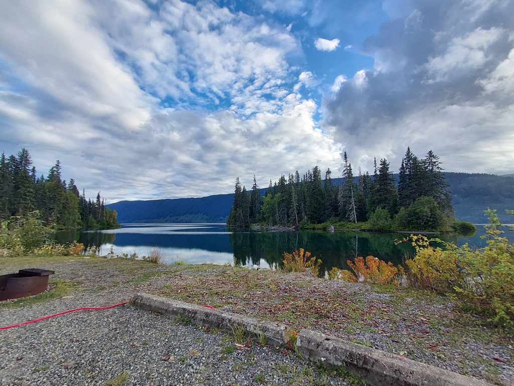
We then packed up to head north. We got back onto the Yellowhead Highway, grabbed groceries in Smithers and eventually made a righthand turn onto Stewart-Cassiar Highway. We saw gorgeous views of snow-topped mountains and glaciers on our way and the road eventually led to Meziadin Lake Provincial Park. We arrived at our lakeside site with views of mountain peaks nestled in behind the treeline. The terrain had changed again, from the more arid valleys of Central BC to the northern boreal forest.
We heard from our neighbour that a three-year-old male grizzly frequents the area and that morning he saw the youngster walk through our then empty site to eat some berries and swim to the nearby island. Our neighbour also saw a mother grizzly and two cubs walking near the campground’s entrance. For good reason, the park is covered in grizzly bear warning signs and even has an area contained by electric fence that tent campers must stay within overnight.
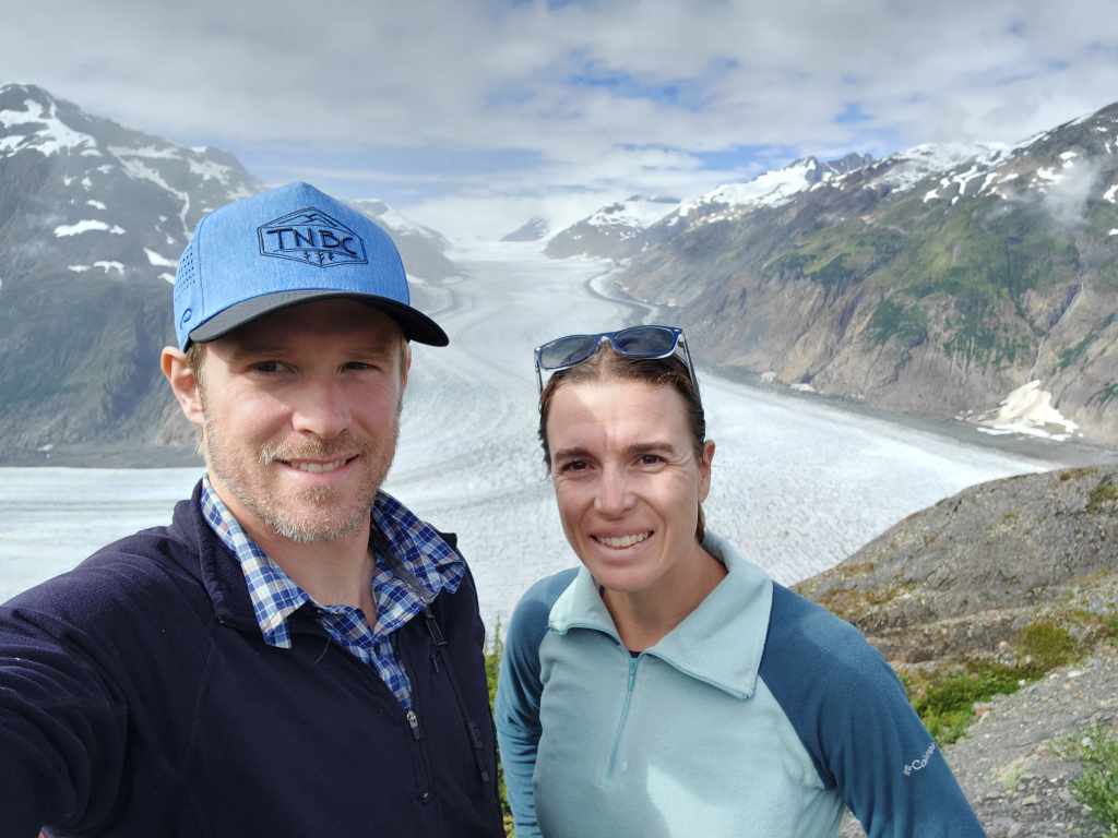
With biking, running and hiking off the docket on account of not wanting to encounter Grizzly bears, we had a forced brief hiatus from any endurance activities. Since it was safe to travel by vehicle, we did the self-directed driving tour to see Salmon Glacier near Stewart, BC and the “ghost” town of Hyder, AK. We first drove past the Bear Glacier, which used to touch the lake below but has since receded up the slope. In Stewart, a small town of 500 people, we strode down a boardwalk that led into an estuary with the old pilings where the original town was built; imagining an entire town suspended above the marsh was remarkable to think about. From there, we briefly passed through Hyder (our only non-Canadian portion of the trip!) and then after a few kilometres crossed back over into BC. While across the border, we drove through America’s largest national forest, the Tongass National Forest, which covers over 17 million acres. We kept climbing up a mining service road that was carved out of the side of a mountain. To give you a visual: there was us on the road, a very deep river valley beside us and then another mountain range on the other side.
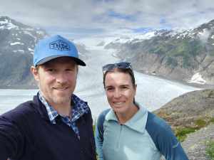
At the top of the road was the gigantic Salmon Glacier. The landscape was incredible and fueled our wanderlust. The drive and scenery were beautiful, as long as we weren’t too close to the road’s edge! Interestingly, we didn’t need our passports to go into Alaska, but we had to pass through border security to return to Canada – seemed kind of strange to us that the American crossing wasn’t fortified at all (though maybe the ghosts of Hyder keep watch)!
On the tour, wildlife sightings were abundant, with loons, eagles, hawks, mosquitos, and a big boy grizzly. We slowed down and then stopped because we saw Mr. Griz on the side of the road. It was a good thing we came to a halt because he decided to cross the road right in front the truck. That evening, we chatted with our lovely site neighbours and then had Greek pasta salad with a side of burnt bacon (we got distracted by conversation).
Boya Lake
The next day we made a big drive further north on Highway 37. We left Meziadin Lake and made our way to the first pit stop at Mehan Lake. We then stopped for a quick mid-drive shakeout at Upper Cascade Falls in Kinaskan Provincial Park. It was quite windy, but the rain had stopped briefly and so we laced up our trail shoes and started down a lovely 2.5k trail. We heard the water before we saw it and once we got to the end of the small peninsula, we were surrounded by the falls’ rushing water. After we made our way back to the truck, we had some lunch and felt refreshed and fuelled for the rest of the drive.
We stopped in Dease Lake for fuel as not many options exist within the next four hours of driving. The going rate for premium gas at the time was $2.52/L and diesel was $2.86/L – wild! We filled up with water here as well and then proceeded on the final two-hour leg of the day’s journey. The road was in decent shape, with lots of big rollers and mountain views on both sides of the road. Also characteristic of BC roads, guardrails are often not in place to prevent vehicles from plunging into the deep river valleys below. So, classically I quickly peered over the edge on the right and leaned left hard into my seat. By the end of the day, we reached Tā Chʼilā Provincial Park, also known as Boya Lake. We pulled up to our lakeside site and took in the views of the adjacent mountains. We made some burgers and built a cheery fire for some heat as fire bans were lifted here. While the calendar suggests a couple more weeks of summer, overnight single-digit temperatures indicated fall had arrived early.
We only had a reservation here for one night because that was all that was available when we booked, and so we were prepared to pack up and find a first come first serve site the next morning. We had scouted out some nice options and then the park manager let us know that a cancellation made our site available for another night – score! No need to pack up or move for another day.
After lunch, we rented a canoe and paddled around Boya Lake. Its turquoise water is from the sun reflecting off the white marl, made of silt and shells. The lake itself was formed by a glacier over 20,000 years ago. One could spend days exploring the shorelines, bays, inlets and islands. We counted over a dozen beaver lodges along the various shorelines, and they’d built dams in the narrow shallow gapes to keep water levels in some bays over a metre higher than the lake. We then headed out for a 6km jog around the campground and nearby interpretive trails. Upon completion, I had the grand idea to take advantage of the slight inclination I had to get in the water. To my surprise, the lake was so frigid it quite literally took my breath away. Lake Boya is supposed to be the warmest lake in Northern BC. But not warm enough for me to wade about – off to a hot shower! In the evening, we made tacos and a big ole fire.
The time has finally come to head into the Yukon! Let us know what you think of this update in the comments below.

2 Responses
You drove through Hazelton!!! Should have stopped to hike Stekyoden/Hagwilget Peak. Maybe on the way back 😉
As we drove through, I told Cody – This is where Regan is from!! Gorgeous area! We’ll definitely add those spots to our future travels up here 🙂